Wednesday, May 23, 2012

Grand Canyon: Tonto Trail Loop -- Some Solitude!


Above: Some of the dazzling scenery down the South Kaibab Trail en route to the Tonto Trail.


It's a "grunt," as one hiker I met on the Tonto trail exclaimed, but it is a challenging day hike in the Grand Canyon to take the South Kaibab trail down (4.6 miles), then the Tonto Trail West (4.6) miles across to the Bright Angel Trail and then that trail up and out of the canyon (4.9 miles).
All total it covers 14.1 miles and descends and climbs about 3,600 vertical feet.
It took me about 8 hours to hike the loop.
This is not an easy hike, it is very strenuous and I recommend only doing it in the spring, fall or winter.
And, whenever you do it, get an eary start in the morning.
For me and my son, Taylor, on May 20, 2012, we parked near the Bright Angel Lodge and then took the hiker express bus to the Kaibab trailhead.
So, when we finished, there was our car about 170 yards away.
You've got to carry ample water on this trip. In fact, of two mistakes we made on our hike, one was in not dumping our extra water over us to cool us down as we were halfway across the Tonto trail segment, where temperatures were into the mid 80s.
Our other mistake was that we failed to walk an extra hundred or so yards to look over the cliff and enjoy the view at the Tipoff. (So, we missed seeing Phantom Ranch and the suspension bridge.)
That second mistake was caused in part by our hurry to get away from a way too large hiking group of some 40 people together, who were making oodles of noise and disrupting our pleasant hiking experience. Fortunately, they on the Kaibab Trail only.
(There ought to be a law in National Park statute, that no groups of 12 or more people are allowed on such a trail! Sadly, there is such a directive in Zion National Park, but not the Grand Canyon.)
DO NOT hike the inner Grand Canyon on a weekend or holiday, unless you want to deal with bigger crowds of hikers.
Anyway, the pleasure of the Tonto trail is that it is wilderness. No signs, very narrow and super quiet. We only saw or met some 6 people on our two hour jaunt across that path. (Compare that to the hundreds of people we met on the other Grand Canyon trails.)
There are two water sources along the Tonto trail, if you purify the water. Otherwise, it is a very hot, pure desert kind of experience, with lots of cactus.
This segment of the Tonto trail is amazingly level and only has occassional ups and downs of any significance.
The Tonto trail is so long, because it has to go around the one big drainage that looms northwest from Cedar Ridge and O'Neill Butte.
I also recommend extra safety and caution along the Tonto Trail, because if you get into trouble there, a rescue could take hours longer than it would along the much more well traveled Kaibab and Bright Angel paths.
So, if you want a challenge and something different in the Grand Canyon, this might be it.
For me, after having done the inner canyon hikes on the south rim twice and once partially, plus the north rim to Ribbon Falls and back once, this was indeed a much different kind of hiking experience.


Also, with traffic on the Bright Angel and Kaibab trails now making them busy hiking freeways,the Tonto trail may offer the kind of solitude and true peace you are going to find in the inner Grand Canyon these days.
--It is one of those hikes I would probably never do again, but then that's because it is a grunt.
Also, it is kind of humorous to recall this one experience now, but as we crested a small ridge, we weren't sure where we were and we were tired and very hot. We spotted a sign that we thought said Indian Gardens 3 miles and intitally failed to spot the point on the .3 miles on the sign.
--I also have to complement the National Park Service. Somehow in recent years, they are covering or taking off a lot of the mule poop off the Bright Angel Trail regularly. This is a great improvement over my previous hikes there in 1984 and 1994.

Wednesday, May 2, 2012

Yosemite Fog Danger

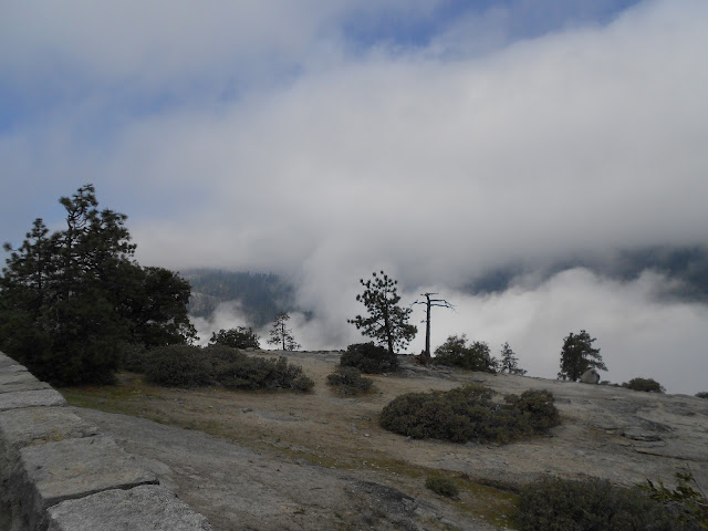
IN addition to the gross lack of emergency communications with the public that Yosemite National Park (and likely what most NPs have), there is a key, lesser-talked about hazard in Yosemite -- thick fog along roads -- especially in spring time.
As I was driving down at dusk from Glacier Point in Yosemite on April 24, 2012, several large and thick patches of fog drifted a long the narrow roadway.
I simply could not belive how I could only see about 5-10 feet in front of the car. Without barely being able to see the yellow line in the middle of the road and white line on roadside, I was completely blind.
When i t gets dark in mountaineous Yosemite, where there is little light poillution and when there is no moon, it is cave dartk, pitch black, and fog and compound the problem.
Luckily the 2 patches of fog only lasted about 45 seconds each and the roadway cleared, but if some areas of Yosemite are ever completely fogged in, good luck!
Snow is one thing, but fog can be worse.


The accompanying photos show fog in Yosemite Valley on the morning of April 22, 2012. However, it is at night when such thick fog can be crippling to motorisits.

Tuesday, May 1, 2012

Trapped in Yosemite National Park!


OK, Yosemite National Park in central California is a pure paradise, a Garden of Eden, a  Shangri-La.
However, myself and three family members were trapped there overnight on April 22, 2012 and it was not a pleasant experience, not being prepared for an overnight stay, or having a bed or any bedding.
A huge sulphur spill just outside the south gate to Yosemite closed Highway 41 completely for some 36 hours and created a problem for hundreds of visitors.
We missed booking the last room in the historic Wawona Hotel, on south side of Yosemite, and had to crash in the lobby there  overnight. (The alternative was driving some four hours on winding canyon roads in the dark -- on  moonless night -- to get back to Bass Lake, where we were staying.)
Several dozen other guests were in the same boat, as the 40 vacant rooms in the Wawona had went quickly.
But a good night’s sleep you did not get and my mother with Alzheimer’s was particularly a problem. (But I guess we stayed free and saved the $165-plus hotel cost.)
Wawona is only 7 miles from the Yosemite Park gate and the spill just outside that gate at 5 p.m. on April 22 started several small fires and the cleanup kept the road closed until the morning of April 24.
No one ever explained why such hazardous materials were being transported through a national park and on such a winding, narrow road.
Also, this experience again shows that America’s National Parks are simply not prepared for any kind of disaster. All national parks appear to lack any kind of emergency communication systems.
For example, this  sulphur spill happened at 5 p.m. and when I left Yosemite Valley after 8:30 p.m., there was no ranger, no system in place to tell anyone the road was closed one hour’s drive away!
Drivers had to fend for themselves and discover the road closure on their own. I guess I expect more in this high-tech world of communications.
Wawona Hotel employees said in at least a decade, even snowstorms had not closed Highway 41 before so completely and so long term.
Wawona employees did the best they could, but even this hotel appeared to have no official emergency plan in place to deal with the situation.
Couldn’t Yosemite have placed a park ranger with a flasher at the south tunnel leaving Yosemite along Highway 41 to tell motorists of what was an hour ahead? It could have, but it didn’t.
Now I could have had some emergency things along in the car, but who would expect such a closure?
I counted at least 40 cars that turned around and headed back to Yosemite and exited a different gate late that evening. They all drove some 2 hours out of their way just to exit the park. Most had to be headed for Oakhurst or beyond and so they had a longer drive ahead after leaving the park.
I felt such a drive when it was such a dark, moonless night and I was so tired was simply not a wise choice. And, the chance of animals on the road was a possibility too.
The others, like me and my group, stayed at Wawona, probably another 40-plus vehicles. And, they all had to depart Yosemite the next day a different direction, with the south entrance still closed.
Ironically this road closure happened during the annual free admission to national parks weekend.
If there was a much larger disaster in Yosemite, the park’s communications are sorely  lacking.
Ideally, if Yosemite had 4 or so electronic message signs placed around the park, these could quickly alert drivers at any one of the four exits to the park of any problems ahead.
This was the SECOND time in 22 months that I’ve seen big gaps in National Park communications.
In mid-June of 2010, I entered the north gate of Yellowstone National Park one morning and  headed  an hour-plus drive  away for Tower Junction. When I reached Tower, the road southward was blocked.
An ice storm overnight had iced the road and so it was closed until mid-afternoon, when the sun had  melted the ice.
The park ranger at the north gate was not told anything about this closure  and once again, visitors had to fend for themselves.


I lost hours in unnecessary travel time that day.
The director of the National Parks System needs to realize how both Yosemite and Yellowstone have no emergency communications plans in place. They are some of the most popular and largest in all the parks system and so if they are lacking, likely every other national park is too.

UPDATE: My mother came down with bacterial pneumonia a week and a half after her trapped in Yosemite experience. She'll survive and I can't be sure that one bad night weakened her, but it certainly didn't help her.
SECOND UPDATE: The park superintendent finally responded to my plight, but stressed that rangers are too busy saving lives of climbers/hikers and the like in Yosemite to worry at all about road closures.