The traditional depiction of life on the Mormon Pioneer Trail is a dismal one of tragedy and suffering — almost like one long funeral procession.
But Melvin L. Bashore, a senior librarian in the history library of The Church of Jesus Christ of Latter-day Saints, also promotes "A Funny Thing Happened on the Way to Utah: Laughable Incidences on the Mormon Trail."
He says even if some of these happenings weren't funny to the pioneers, they seem to be today.
For example, one his favorite stories concerns a very old Danish man who had completely lost his sense of smell and was part of an 1857 pioneer group headed for Utah. After some men killed buffalo and other major game for the group's food, he thought he should make a contribution, too.
He came back to camp with a skunk to cook for soup.
"This made the rest of us leave," C.C.A. Christensen, a member of that Danish company, wrote in a diary. "He had killed it with his cane and knew nothing about its peculiar means of defense."
Some other stories involve mosquitoes, which seemed to particularly like attending Mormon meetings on the Plains.
An 1861 diary records: "In the evening a meeting was held in camp, but the mosquitoes were there first and stay there they would. They sang at the opening song during service, at the closing and finally sung all night. Tried to sleep, but they pulled me out of bed."
An 1853 diary reported: "I saw Indians by the hundreds, buffalo by the thousands and mosquitoes by the billions."
In still another tale, a young pioneer man had to separate from his fiancee and travel with a separate wagon group because he didn't have enough money so they could travel together. His diary on the first night of separation states:
"My mind was rambling over many things, especially as to when I should meet my dear girl again. After a while we began to turn in. I had occasion to go to my bag for some clothes and in taking out what I expected to be white duck sailor overalls and holding them up an examining them they turned out to be some sort of ladies' unmentionables trimmed and adorned with lace. The eyes of the crowd caught onto it. I had made a mistake and got my sweetheart's bag instead of my own."
In his research, Bashore found the vast majority of the pioneers didn't die along the way but safely made the journey to the Salt Lake Valley.
Bashore said that although hardships did occur on the trail, Utahns today falsely often skew our perception and understanding of the entire history of what happened on the Mormon Trail by dwelling on the sufferings of a few.
• Bashore's overview of the Mormon trail experience is available online at: overlandtrails.lib.byu.edu.
(Adapted from a July 24, 2004 story in the Deseret News by Lynn Arave.)
--- The Mormon pioneers entered the Salt Lake Valley in 1847. Despite the fact this is one of the most epic events in regional history, there are a lot of myths and fallacies circulating regarding the pioneers and their trek and arrival in the valley.
For example, the travel of the pioneers to Utah — excepting the handcart companies — was likely not as difficult as many perceive it to have been.
"Contrary to myth and popular belief, this 1847 trek of approximately 1,032 miles and 111 days was not one long and unending trail of tears or a trial by fire," The National Park Service's "Mormon Pioneer: Historic Resource Study"(www.nps.gov/history/history/online_books/mopi/hrs5.htm) states.
"It was actually a great adventure," the NPS report continued. "Over the decades, Mormons have emphasized the tragedies of the trail, and tragedies there were, but generally after 1847. Between 1847 and the building of the railroad in 1869, at least 6,000 died along the trail from exhaustion, exposure, disease and lack of food. Few were killed by Indians. To the vast majority, however, the experience was positive — a difficult and rewarding struggle. Nobody knows how many Mormons migrated west during those years, but 70,000 people in 10,000 vehicles is a close estimate.
"To the 143 men, three women and two children who left Winter Quarters, the 111-day pioneer trek of 1847 was mostly a great adventure, with a dramatic ending."
Also, a second myth is that handcart travel was both common and typical for numerous pioneers. Given all the attention LDS stakes have given their own personal mock handcart adventures in Wyoming, this exaggerated belief is logical, but incorrect.
Using the most commonly accepted estimate of 70,000 total pioneers coming to Utah between 1847 and the coming of the railroad in 1869, plus the handcart estimate total of 2,962 people, the total percentage of pioneers who were in handcart companies is only 4.23 percent.
Bashore said handcart companies have evolved to be the "iconic symbol of pioneer Mormonism."
"We're focused on what a lesser number of people did," he said.
(That is why I don't personally care for handcart "treks" by stakes and wards. Accurate history is rarely taught on them and their entire focus is just a sliver of pioneer travel.)
--Following are some other pioneer myths:
• Death was a common occurrence on all pioneer treks. Not true, as most who started for Utah arrived. For example, no one died in the original 1847 pioneer company to Salt Lake.
The average death rate in all Mormon companies was less than 3 percent; a third of the companies (more than 80) did not have any deaths at all; only 18 of the more than 250 companies experienced more than 20 deaths en route (so only 7 percent of the total companies accounted for 43 percent of the total deaths); and at least seven people were bitten by rattlesnakes, none of whom died.
• Pioneers all traveled basically the same route. False. For example, variants in trails were established in southern Iowa, or via Mitchell Pass in Nebraska or in not crossing the Platte River at Fort Laramie in Wyoming.
Also, many pioneers from 1850 on used the "Golden Pass Road" (Parleys Canyon) to enter the Salt Lake Valley instead of Emigration Canyon, making some 42 miles of trail different at the end of the trek.
The John G. Smith pioneer company of 1851 was counseled by Elder Orson Hyde to head for the Elk Horn River in Nebraska before reaching the usually traveled road. That meant several hundred miles of different route.
There were many other variations too, especially on the later treks. Some came from California, others from Texas.
"We tend to think all trail travel started in the Midwest," Bashore said.
• The pioneers entered the Salt Lake Valley on July 24, 1847. Not quite accurate. The lead company and the main company of pioneers actually entered the valley on July 22 and camped there that night. Meanwhile, Brigham Young and the rear company had not yet climbed Big Mountain, and it didn't enter the valley until July 24 — the celebrated day.
In addition, two advance scouts, Orson Pratt and Erastus Snow, had even entered the Salt Lake Valley a day earlier on July 21.
• Brigham Young declared "This is the place." Not a complete statement. "It is enough. This is the right place, drive on" is the full declaration President Young may have made. However, there is still doubt.
Jeffrey Carlstrom and Cynthia Furse, in their book "A History of Emigration Canyon," note there is "considerable room for doubt that Young ever made this famous pronouncement." That's because no firsthand accounts of it exist.
Wilford Woodruff is credited with recounting what President Young said, but that was in 1880, 33 years after it happened and about three years after President Young had died.
• This Is the Place Monument is located exactly where Brigham Young made his famous statement. Unfortunately, history didn't leave us with an exact location. However, when the original monument on the site was dedicated on July 25, 1921, Elder B.H. Roberts, a member of the Seventy and a church historian, cited a journal of President Woodruff that "proved conclusively that there can be doubt that the spot now marked by this concrete monument is very near to the actual place."
• There was a "lone tree" in the barren Salt Lake Valley when the Pioneers arrived in 1847. It is simply pioneer legend that paints such a grim picture of the Salt Lake Valley — barren, harsh and a desert, save a lone cedar tree. In reality, say historians, the valley was well-watered, with tall grasses and trees along the many stream banks.
"One of the greatest myths of the church is that the valley was total desolation," said the late Dr. Stanley Kimball, a Utah historian. No pioneer diary accounts he ever found supported the desolate valley idea.
Most of the paintings depicting the valley when the Mormon pioneers arrived look more like the west desert area than the Wasatch Front.
Richard Jackson, professor of geography at Brigham Young University, did extensive research in the 1970s on what the Salt Lake Valley was really like when the pioneers arrived.
"Briefly, there was not a lot of timber in the valley according to pioneer diarists, but there was clearly some, especially along the creeks," he said.
But regardless, the pioneers did not have an easy time in Utah, and some people still feel the desert of Salt Lake did "blossom like a rose."
"Settling the Utah area in the 1840s and '50s was a challenge," Glen Leonard, director of the LDS Museum of Church History and Art, states on the church Web site, lds.org.
"They had left a lush farm area and came to an arid region. The soil was good, but the water was scarce. The seasons were short. So, Brigham Young wisely scattered the people out into small communities so that they had the natural resources — the water and the soil — and the community resources, the well-organized communities with different skills and talents, and then he just challenged them to make the desert blossom like a rose. And they did."
• Other handcart myths. Chad M. Orton, an archivist with the LDS Church's family history department, has researched various handcart pioneer legends. A recent newspaper obituary that made reference to one of the deceased's ancestors as deceased ancestor's as having been a handcart pioneer in 1847 best illustrates the wide misconceptions about of handcart pioneers. There were none in 1847.
• Missionaries at Martin's Cove in Wyoming occasionally mention to visitors that several tree stumps in the C cove offer evidence to prove the handcart pioneers were situated there. Neither Both Orton nor and Bashore has found have found no historical evidence to support that belief.
• Sometimes it is said that none of the survivors of the Willie and Martin handcart companies ever left the church. Orton said that's false because there were some who apostatized.
• There's also no evidence that handcart wheels were made out of green wood.
• Handcarts didn't carry everything these pioneers had. All handcart companies traveled with supply wagons that carried tents, extra food and other provisions too, according to Orton. One wagon was allocated for about every 100 members of a handcart company.
•The Mormon Pioneers universally were unique in one other way — no pioneer parties hired guides to take them west. Mormon Pioneers did all the advance research they could and then relied in the church leaders with them for guidance.
(Adapted from a July 24, 2008 story in the Deseret News, by Lynn Arave.)
Tuesday, November 27, 2012
Salt Lake Lone Tree Myth False
Pioneer legend paints a grim picture of the Salt Lake Valley — barren, harsh and a desert, save a lone cedar tree.
In reality, say historians, the valley was well watered, with tall grasses and trees along the many stream banks.
"One of the greatest myths of the church is that the valley was total desolation," said the late Dr. Stanley Kimball, a Utah historian. No pioneer diary accounts he ever found supported the desolate valley idea.
Most of the paintings depicting the valley when the Mormon pioneers arrived look more like the west desert area than the Wasatch Front.
Richard Jackson, professor of geography at Brigham Young University, did extensive research in the 1970s on what the Salt Lake Valley was really like when the pioneers arrived.
"Briefly, there was not a lot of timber in the valley according to pioneer diarists, but there was clearly some, especially along the creeks," he said.
But regardless, the pioneers did not have an easy time in Utah, and some people still feel the desert of Salt Lake did "blossom like a rose."
"Settling the Utah area in the 1840s and '50s was a challenge," Glen Leonard, director of the LDS Museum of Church and Art, states on the church Web site, www.lds.org.
"They had left a lush farm area and came to an arid region. The soil was good, but the water was scarce. The seasons were short. So, Brigham Young wisely scattered the people out into small communities so that they had the natural resources — the water and the soil — and the community resources, the well-organized communities with different skills and talents, and then he just challenged them to make the desert blossom like a rose. And they did," Leonard concluded.
Comments by Young, Heber J. Grant and other church leaders made the desert comparison of the valley blossoming like a rose, too.
Many diary accounts support that the Salt Lake Valley was more green that history paintings illustrate:
William Clayton's journal for July 22, 1847, records his first view of the Salt Lake Valley and comments on the land between the mountains and the Great Salt Lake:
"The intervening valley appears to be well supplied with streams, creeks and lakes, some of the latter are evidently salt. There is but little timber in sight anywhere, and that is mostly on the banks of streams and creeks of water, which is almost the only objection which could be raised in my estimation to this being one of the most beautiful valleys and pleasant places for a home for the Saints which could be found."
Jackson said on Sept. 9, 1847, Brigham Young cautioned the Saints before he left to return to Winter Quarters that in "selecting your firewood, it will be wisdom to choose that which is dry and not suitable for timber of any kind, and we wish all the green timber and shrubbery in the city to remain as it is . . ."
Henry Bigler noted in his diary in October of 1848 that he commenced building a house. "I began to make preparations to build me a house on a city lot . . . situated in a very nice part of the city on City Creek, a nice little grove of Box-Elder and Cottonwood on it."
Thomas Bullock, clerk of the Mormon pioneer camp, wrote that the valley was "dotted in three or four places with Timber."
"A valley of about 20 eight miles wide lay before us the most of it covered with good gras and various outher vegatables. but timber was handey," is what Levi Jackman, a member of the original Mormon pioneer group to enter the Salt Lake Valley, wrote (with imperfect spelling) about his first impression.
There was enough water in the Salt Lake Valley of 1847 — even in mid-summer — that the first recorded pioneer death was from drowning, not from thirst. Milton H. Therkill, a 3-year-old boy, fell in City Creek and drowned on Aug. 11, 1847.
Jackson believes when the leaders and members of the pioneer companies of 1847 talked about the lack of timber, they were apparently comparing it to the Midwest and also recognizing that it would be a challenge since their homes had been built primarily of wood, and wood was the primary fuel source. Within a few days of arrival they found lumber in the mountains adequate for their needs.
How did the myth of the lack of trees in the Salt Lake Valley of 1847 start?
Richard Jackson, professor of geography at Brigham Young University, said that idea developed in later years, probably for three reasons:
"First, as the settlers celebrated the 24th of July, the oratory often included a certain amount of hyperbole about the magnitude of the trip across the plains, settling and developing the Salt Lake Valley, etc. As with most reminiscences, the story tends to grow with the retelling, so the Salt Lake Valley became ever more arid in those accounts," he said.
"Secondly, by the 1850s and 1860s when these myths became common, the only land not being farmed or built upon was in fact the worst land that was more arid and so later arrivals concluded that the entire valley found in 1847 by the pioneers was basically the same as the remaining marginal lands in the valley.
"Thirdly, as Brigham Young and the leaders encouraged the settlers to go south to Dixie, etc., the idea that Salt Lake Valley was a treeless desert implied that the farms and city that the settlers had developed with the help of the Lord could be replicated in the more marginal sites he was encouraging settlers to move to," Jackson concluded.
The late Stanley Kimball, a Utah historian, once said he also believed it came about after the desirable valley filled up — consciously or subconsciously to foster the idea that it had been tamed and to encourage people to settle in Dixie and other frontier areas.
Besides paintings, the biggest myth supporter is perhaps the "Lone Cedar Tree" monument in Salt Lake City, in the median on the south side of the intersection at 600 E. 300 South.
The Daughters of the Utah Pioneers erected this monument on Pioneer Day in 1934 to what was supposedly the only cedar tree in the valley when the 1847 pioneers arrived. Some original pioneers are reputed to have sung hymns and prayed by the tree.
One problem with that story is that the pioneers followed the Donner Party trail to about 1700 South, then headed to a small grove of cottonwood trees near today's 300 S. State Street — missing the "Lone Cedar Tree."
Vandals cut the Lone Cedar Tree down on Sept. 21, 1958. A related controversy ensued with the DUP when the media said the tree's status was a fraud anyway. (Ashes from the stolen cedar tree were purportedly found later in a Greyhound bus depot locker.)
A new plaque was added to the monument in 1960 and is still there today — for anyone to see and decide from themselves if the tree's legendary status holds merit.
(Adapted from past Deseret News articles by Lynn Arave.)
Setting the Record Straight on Utah Myths ...

From myths about its physical features to stories concerning legendary pioneer Brigham Young, there are plenty of misconceptions about the state of Utah.
Here’s a look at “Utah Facts 101,” an attempt to dismiss or substantiate various ideas and facts about the state, its history, terrain and population:
• Bankruptcy: Utah leads the nation in personal bankruptcies.
False. The Beehive State isn‘t even in the top five anymore as Nevada, Tennessee, Georgia, Michigan and Alabama claim the most now. (However, back seven years ago to 2003, Utah was ranked first.)
• Bear Lake is one of the deepest lakes in the West and has a bottomless abyss with a monster lurking in it.
Fear not the next time you go swimming, it’s false. It’s only 210 feet deep when full (of water, not bears) and likely below the 200-foot mark in the current drought. (Crater Lake is 1,949 feet deep, Lake Tahoe is 1,645 and Yellowstone Lake is 400 feet deep.) As for the monster, well, it hasn’t been substantiated. But just in case, watch your toes while water skiing.
• Bear River is the nation’s longest river that doesn’t empty into an ocean.
True. Some 500 miles cross through three states. It doesn’t have a monster, either.
Birth rate: Utah does have the highest rate in the nation, but it has fallen in recent years.
True. More Utahns are born here than anywhere else. And U.S. citizens, too — about 21 babies born per 1000 people, though the rate has been falling in recent years under a bad economy.
• Brigham Young famous comment No. 1: Did he really say, “What a withered wasteland!” when entering the Salt Lake Valley on July 24, 1847? Of course not. How about: “This is the Place”? (Question mark for our question, not his statement.)
Sort of. The second president of The Church of Jesus Christ of Latter-day Saints specifically said, “This is the right place. Drive on.” The condensed version just fit better in headlines.
• Brigham Young famous comment No. 2: Did he really say that any unmarried man older than age 25 was a “menace to society” or was he referring only to his great-great-great-grandson, Steve Young?
President Young only said he wanted every man in the land older than 18 to take a wife. It was Elder George Q. Cannon, an LDS Church apostle, who said in 1878: “I am firmly of the opinion that a large number of unmarried men, over the age of 24 years, is a dangerous element in any community.”
• Brigham Young’s famous hearse: It sits in front of the Haunted Mansion at California’s Disneyland, right? (See the photo at the beginning of this blog.)You know, you’ve had your picture taken next to Goofy there, right?
Completely untrue. (The hearse, not the photo.) President Young didn’t have a hearse, according to LDS historian Glen Leonard. He was carried on a slab by other church leaders from the Tabernacle to his grave site. (And, no, the slab isn’t at Disneyland, either.)
• Cain is really Bigfoot: Oh yeah, and he lives in the Wasatch Mountains.
Purely conjecture. This stems from a story on pages 127-128 of Spencer W. Kimball’s “Miracle of Forgiveness,” in which an early LDS apostle, David W. Patten, meets a strange, dark, tall and hairy man who identifies himself as the original Cain from the Book of Genesis. The Bigfoot/Cain idea originated in 1980 following apparent Bigfoot sightings in South Weber.
• Cola/caffeine drinks: Many are under the assumption that the consumption of cola/caffeine drinks are against the LDS Church’s Word of Wisdom and that’s why you can’t find one of these “hard” drinks at Brigham Young University. Others believe Brother Jones saw a church leader drink a Pepsi during a talk once so it’s OK.
Truth is, the church has no official cola/caffeine drink position, according to its new General Handbook of Instructions, issued in 2010. It simply advises against consuming drinks that contain harmful ingredients or which may be addictive (not including milk or red punch).
• Department stores were invented here: Many claim the late ZCMI, or Zions Cooperative Mercantile Institution, was the nation’s first department store and that Brigham Young still has a suit on layaway.
Yes and no. A century before selling out to Meier & Frank in 2001, ZCMI opened in 1867 and was dedicated to giving local merchants a way to sell their stuff for low prices. President Young actually bought his suits at Mr. Mac’s. (OK, not really.)
• Eagle Scouts flock here: Does Utah really produce more Eagle Scouts than any other state?
It’s true, Scout’s honor. Almost three times as many boys earn the award in Utah than the national average. And that’s not counting all the “Life” Scouts who were only two merit badges away. The National Boy Scout office confirmed Utah is still No. 1 back in earlyt 2010.
• Electric traffic lights: It’s a Utahn’s fault that we get stuck at red lights so often.
Could be. According to some accounts, the first traffic light (a birdhouse-type doohickey) was invented by Salt Lake City policeman Lester Wire in 1912. (Here’s hoping a Utahn will discover synchronized lights before 2012.)
• Elevation: Utah is higher (we’re talking sea level here) than any other state in the nation, even higher than Colorado, Alaska and that patch of grass where they held Woodstock.
Bingo. Based on county high points at 11,226 feet above sea level. Utah also has more peaks higher than 10,000 feet than any other state. Even Iowa. That’s why it is life elevated here, though various computerized programs will still support that Colorado is No. 1.
• Flunking the final exam: Perhaps you’ve heard the story or a version of it: Students at either BYU or the University of Utah pass by a beggar seeking assistance on the way to a final exam for an LDS Institute of Religion class on Christ’s life. No one helps the man, actually an actor, and so they all flunk the class.
Jan Harold Brunvand, U. folklore expert, said the story can’t be verified and it also meets two other parameters of urban legends by teaching a moral and being told with slight variations. In other words, they all failed Institute for other reasons.
• Great Salt Lake: It’s so salty, you can walk on it.
False. It’s so stinky sometimes, you can’t get near enough to even try. Only brine shrimp without use of olfactory senses dare go near. But it is the largest salt lake in North America and is three to five times saltier than the ocean (depending, of course, on the chef’s tastes). It’s also the largest lake west of the Mississippi River. (You can float like a cork in some places of the lake, where the salt content is so high.)
• Hunting is a no-no: Some factions believe hunting is against the teachings of the LDS Church, and not because of the unsightly orange apparel.
False. Some past church leaders, like President Joseph F. Smith, taught that animals or birds should not be killed unless they are needed for food. However, a 1979 official church statement said the decision on whether to hunt or fish is left up to the individual. The church is only against the unnecessary and wasteful slaughter of animals and not against hunting or fish and game control.
• Hypnotism is a no-no: You are not supposed to let someone tell you in a monotone voice, “You are getting sleepy” or allow them to make you act like a chicken at a comedy club. It’s against LDS Church doctrine, right?
Partially true. “The use of hypnosis under professional supervision for the treatment of diseases or mental disorders is a question to be determined by competent medical authorities. Church members should not participate in hypnosis for the purposes of demonstrations for entertainment,” a 1999 official LDS Church statement said.
• Ice cream consumption: I scream, you scream, we all scream for ice cream more than anybody else — that’s the common conception at least.
Sorry, Salt Lake City. Portland, Ore., St. Louis and Seattle comprise the top three ice cream consumers. And Utah is not one of the top five producers of ice cream. (This is unacceptable. Hungry, prideful Utahns unite and do something about this — at Leatherby’s and Cold Stone!)
• Jell-O consumption: I Jell-O, you Jell-O . . . uh, doesn’t work as well, but another common conception is that Utah slurps down more wiggly, jiggly gelatin than anyone.
It’s true: Utahns consume Jell-O at twice the national average. No wonder Bill Cosby likes us so much.
• KFC should’ve been UFC: Grandpas have been claiming for generations that the world’s first Kentucky Fried Chicken started in Salt Lake City.
Grandpa wasn’t just pulling your drumstick. The colonel first cooked up his secret finger-licking good recipe with those yummy original spices at the Harmans Restaurant on 3300 South and State Street in 1952.
• Kids play: With all those children running around McDonald’s playlands across the Beehive State, there’s no doubt this place has the most youngsters in the country.
Sure enough. The mean age in Utah is still the lowest in the nation.
• Mount Timpanogos: Not only is it supposedly the highest peak in the Wasatch Mountains, but a really large woman made its peak her final resting spot.
False. Mount Nebo is the tallest at 11,928 feet. Timp registers in at a second-highest 11,750. As for Sleeping Beauty, we won’t know until a really big Prince Charming gives her a smooch.
• Ogden City’s secret tunnels: Legend has it that a vast network of underground tunnels exists below historic 25th Street.
There are some intriguing basements under some of the old bars of the city’s “Two Bit Street,” but there’s no current evidence of widespread tunnels, though a few connections logically might have existed to aid bootlegging traffic and sneaking into Wildcat sporting events.
(Salt Lake City does have plenty of connecting tunnels under the LDS Church campus.)
• Radio stations: The Salt Lake radio airwaves are more crowded than anywhere else.
Believe it. You can tune into as many stations in Salt Lake as Chicago, New York or Los Angeles. (By the way, it only seems like they synchronize their commercials.) Salt Lake also has as many or more sports talk radio stations than any othher market too.
• Rattlesnakes, westward ho! Is it a tall tale, or do Salt Lake County rattlers really migrate each spring from the Wasatch Mountain foothills to the west desert?
This is unfounded. Different snakes live in different locations and can’t travel that far — not even through secret underground passages.
• Salt Lake City will be wickedest: Some claim an LDS Church prophecy predicts this lovely Deseret will become the wickedest den of sin, a downright Soddom and Gomorrah.
Not quite. The actual prophecy made by Heber C. Kimball, an LDS apostle in Brigham Young’s time, states that Salt Lake City will be “classed among the wicked cities of the world.” (This is good news for some.)
• Television birthplace: Thanks to hometown boy Philo T. Farnsworth, Utahns were first to be swamped with infomercials and reality shows.
It is true, at least the part about Farnsworth inventing the TV in 1927.
• The Three Nephites: Various stories around Utah credit these three “translated beings” from Book of Mormon times for performing modern-day miracles.
However, Elder James E. Talmage, an early LDS leader, said the Three Nephites would be the most overworked of all individuals on the basis of all the feats being attributed to them.
• U.S. Constitution: It will “hang by a thread,” according to one LDS prophecy of the last days, won’t it?
Joseph Smith indeed made this prophecy, though later recollections by other church leaders indicated it may or may not be saved, depending on if God wants it saved.
• The Vanishing Hitchhiker: An elderly man was picked up off the side of the road and began warning the people in the vehicle they should have adequate food storage. Then, suddenly, he vanished from the back seat in a ghostly manner.
Brunvand, University of Utah folktale expert, believes the LDS tale comes from prevalent non-LDS stories of similar, but never substantiated, occurrences. That he was carrying a “Kolob or bust” sign should’ve been a clue this was an urban legend.
• Wasatch Mountains: They run from Nephi to Brigham City, or do they?
Actually, they go from Nephi to Soda Springs, Idaho, a 220-mile distance, and include several “fingers,” including the Wellsville Mountains.
• Wellsville Mountains: Some claim the steepest mountains in the world are west of Wellsville.
That story’s on a slippery slope, according to Donald Currey, chairman of the U. geography department, who labels this steepest claim as “purely rhetorical.” Although they are steep and very narrow in the Sherwood Hills area, there’s no known formula for determining steepness. At a maximum height of 9,372 feet, they are also far shorter than many other ranges.
Adapted/updated from July 23, 2003 Deseret News story by Lynn Arave and Jody Genessy
Tuesday, November 13, 2012
"Great Stone Face": Obscure Utah Treasure For Mormons
By Lynn Arave
Does a likeness of Joseph Smith Jr., first
president of The Church of Jesus Christ of Latter-day Saints, exist in the vast
Millard County deseret, southwest of Delta?
Some believe so.
On a remote hillside in Utah's Sevier Desert,
about four miles southwest of Deseret and some 17 miles southwest of Delta,
rises a craggy volcanic outcrop. For almost seven decades, area residents and
visitors have been attracted to the formation.
In it, they can discern the outlines of a
man's features: head, brow, nose, mouth and even perhaps a high collar.
Welcome to the "Great Stone Face,"
or the "Guardian of Deseret," or "Keeper of the Desert."
From a certain angle, notes the book "A History of Millard County," a
1999 entry in the Utah Centennial County History Series, "some see a
resemblance to LDS Church founder Joseph Smith."
This remains a still seldom visited outdoor treasure for Mormons.
The Great Stone Face was originally called "Guardian of the Deseret" by Millard County newspapers during the 1920s, the era when it first claimed local fame as a tourist destination.
(Part of that reference is for the nearby town of Deseret.)
The Great Stone Face was originally called "Guardian of the Deseret" by Millard County newspapers during the 1920s, the era when it first claimed local fame as a tourist destination.
(Part of that reference is for the nearby town of Deseret.)
"Many Mormons see an uncanny resemblance
of this naturally carved formation to profile pictures of church founder Joseph
Smith," Millard County's official tourism site www.millardcounty.com reads.
Whether or not it is partly the power of
suggestion, there definitely is a face to be spotted here in the rocks, though
some may argue whose face.
Visitors have to decide that for themselves at
the site, about 150 miles southwest of Salt Lake City.
The rock pillar sits some 150 feet above the
Sevier Desert floor amid a field of lava rock and sagebrush, with a view to
Notch Peak to the west.
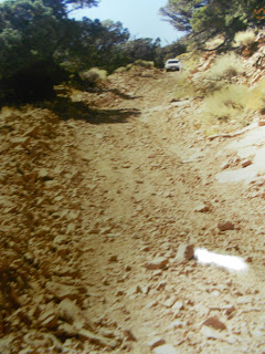
A steep scramble along a 400-yard-long trail
takes hikers to the base of the monument over loose rock. A rugged path,
outlined by lava rocks, marks the way.
Indian petroglyphs dating back about 1,000
years are found in the general area just north of the Great Stone Face. These
markings are now highlighted by a new sign.
--To reach this natural wonder, travel to Delta
and then go southwest on U.S. 6/50 about five miles and turn south on state
Route 257.
Then travel about six miles south on S.R. 257
to a signed turnoff to the west (right).
Go west on the gravel road and travel for
almost six miles to the north edge of the black lava beds. The gravel road —
passable by cars in dry weather, though there are washboard ruts in the road in
places and three cattleguards to cross — loops around the west side of the hill
and ends at a small parking area. There is no admission fee.
The petroglyphs
are located just a few hundred yards before the parking lot and feature their own sign.
These inscriptions were jokingly called the first edition of the Deseret News back in the 1920s and 1930s by Millard County newspapers.
These inscriptions were jokingly called the first edition of the Deseret News back in the 1920s and 1930s by Millard County newspapers.
Hike south up the hillside, looking for the
dominant rock. Those who can't or don't want to hike can still see the Great
Stone Face from a distance, best viewed with binoculars.
This is a moderately strenuous hike up the hill side.


(The accompanying photos show the Great Stone Face, as well as the petyroglyphs sign.)
For more information on the Great Stone Face, go to:
http://www.millardcounty.com/places-to-see/great-stone-face.html
(Modified, but originally presented in the Deseret News, May 13, 2010, by Lynn Arave.)
Thursday, September 27, 2012
Last Visit To The Utah Noodle Parlor in Ogden: Closed for Years Now
I made my last visit to Ogden's Utah Noodle Parlor on Sept. 27, 2012.
The restaurant, 3019 Washington Blvd., closed its doors for good Saturday, Sept. 29, 2012.
It was a 60-plus-year-run for the Chinese restaurant and it was the last of about four historic Chinese eateries that were in downtown Ogden starting in the 1950s. Utah Noodle was the last of the four to shut down.
(Star, Bamboo and China Nite were the other three similar Ogden restaurants.)
Utah Noodle opened just after World War II on Grant Avenue, probably in late 1945, meaning it has been around for about 67 years (despite the sign in the restaurant saying just 60 years). It moved to its Washington Blvd. location in the 1960s.
According to one of the workers, Utah Noodle is being closed because no one in the family would take over its operations. All of its management are in their 80s now. Two nephews who were interested in keeping it going, couldn't, because of health reasons. The original family owners died in the 1990s.
During my last visit, my wife and I both thought our food was as good as always, though the place had went somewhat downhill in recent years and had sported a for sale sign for about a month.
Surprisingly, at 4 p.m. on Sept. 27, it was crowded. Only a few tables were open and about 55 patrons were eating there at the time. It was a long, 40-minute wait, for our food, probably because there was so many takeout orders going out the door.


As one man was overheard to say to waitress near my table, "I've been coming here since before you were born."
After the Ogden Standard-Examiner runs a story on Utah Noodle closing, later this week, I'd hate to be in line to go there on Friday or Saturday.
I'd say Utah Noodle had its peak in the 1990s.
I also believe the restaurant was indeed inconsistent during the past decade. It also didn't promote itself and many of its most loyal of customers died, or ended up in rest homes and were not replaced by a new generation.
In fact, the west seating area of the restaurant was never used in its final years, for lack of business.
The place was always closed on Monday and infamous in my family for closing during several weeks of the year, with little regularity and usually when my family was planning on eating there.
One thing Utah Noodle had in common with my family was that its paneling inside is identical to what's on the wall in my basement family room and hall. My wife's family also went there a lot in the 1980s and the 1990s for extended family meals.
UPDATE: May 2020: Almost 8 years after closing down, the old building that housed Utah Noodle is still vacant ...
Tuesday, September 11, 2012
Media Fallacy: Climbing is Not Hiking
Some things never change.
Often on mountain rescues, the media -- TV, radio and newspapers -- interchange hiking and climbing as if they are exactly the same thing.
This often leads to misleading representation about where a rescue was located.
Example: September of 2012. Several climbers require a very difficult rescue on what the media identifies as Willard Peak, north of Ogden
For several days after, I ponder how Willard Peak, as craggy as it is, could require such a technical rescue effort.
Finally, it is revealed in the media that the rescue actually took place on the London spire, a technical climbing area well below the actual summit of Willard Peak.
So, these 2 men were not really hikers, they were climbers and ill prepared at that.
Hiking is a sport that uses trails and does not require the use of ropes, cables or anything technical. You walk to hike.
Scrambling is kind of in between hiking and climbing, but still requires no special equipment.
Climbing is a technical sport that uses ropes, handholds, etc. to traverse a very steep area.
You might have to hike a ways to begin a climb, but the two are not the same, or interchangable.
The photo below shows the final climb up Mt. Olympus, east of Salt Lake City. It is not a pure hike, since the last few hundred yards are a scramble up a steep rock face, relying on crevices and foot holes in the rock.

Friday, August 31, 2012
The Utah Town That Isn't In Utah!
Many times jokes are made about Park City and/or Moab not really being Utah towns, based on their social and religious differences with most other municipalities in the Beehive State.
However, the one single town in Utah that truly isn't in Utah is Navajo Mountain.
Although this town's trading post, schools, Navajo Tribal office and U.S. Post Office are all at least three to five miles inside the Utah border, that's all there is to Utah about it.
The vast majority of vehicles you will spot in Navajo Mountain sport Arizona license plates.
The area code there is 928, Arizona based.
Also, the U.S. Post Office there states Arizona, instead of Utah.
Navajo Mountain is in southeastern Utah, with Page, Arizona, as the nearest town of significant size.
To reach this community, you have to travel deep into Arizona by way of Page or Monument Valley. Then, between the small Navajo towns of Kaibito and Shonto, just off highway 98, you go north into Utah.
So, the only access to this town is from Arizona. Hence, likely why Arizona dominates this Utah community.
Sitting on the southeast corner of Navajo Mountain, a free-standing, huge, whale looking kind of mountain that rises to 10,388 feet above sea level.
The photos below show: 1. a doctored sign near the community of Navajo Mountain; 2. what it looks like on the top of Navajo Mountain, looking north to Lake Powell; and 3. how rough and rugged the jeep road is up Navajo Mountain.


"Navajos consider Navajo Mountain as a sacred area, and ascending it is forbidden," as stated on the official Navajo Tribe recreation Web site,
http://www.navajonationparks.org/permits.htm
Notwithstanding, myself and several friends did officially aquire outdoor permits from the Navajo Mountain Tribal Office and visited its summit in 2005.
Although I had verbal permission days earlier from the area's tribal president to visit Navajo Mountain's summit, it took the explanation of a bet I had with my two buddies that you could see Rainbow Bridge with your naked eye from the top and north side of the Navajo Mountain Summit, to get them to issue us permits.
I did win the bet, as you can easily spot Rainbow Bridge from on top.
A rugged, narrow, winding jeep road accesses the summit of the mountain.
There are some cell towers on top of Navajo Mountain, so it could be argued it is not as sacred to the Native Americans as it used to be.
In fact, boating or camping on the south end of Lake Powell, you likely wont' have any cell phone service unless you can see Navajo Mountain -- a line of sight kind of thing.
Navajo Mountain was originally known as Paiute Mountain until about 1933.
It remains a mysterious place, full of solitude and solace.
The mountain domninates the area landscape and I'm very thanful I was lucky enough to visit it and enjoy its spectacular landscape.
However, the one single town in Utah that truly isn't in Utah is Navajo Mountain.
Although this town's trading post, schools, Navajo Tribal office and U.S. Post Office are all at least three to five miles inside the Utah border, that's all there is to Utah about it.
The vast majority of vehicles you will spot in Navajo Mountain sport Arizona license plates.
The area code there is 928, Arizona based.
Also, the U.S. Post Office there states Arizona, instead of Utah.
Navajo Mountain is in southeastern Utah, with Page, Arizona, as the nearest town of significant size.
To reach this community, you have to travel deep into Arizona by way of Page or Monument Valley. Then, between the small Navajo towns of Kaibito and Shonto, just off highway 98, you go north into Utah.
So, the only access to this town is from Arizona. Hence, likely why Arizona dominates this Utah community.
Sitting on the southeast corner of Navajo Mountain, a free-standing, huge, whale looking kind of mountain that rises to 10,388 feet above sea level.
The photos below show: 1. a doctored sign near the community of Navajo Mountain; 2. what it looks like on the top of Navajo Mountain, looking north to Lake Powell; and 3. how rough and rugged the jeep road is up Navajo Mountain.


http://www.navajonationparks.org/permits.htm
Notwithstanding, myself and several friends did officially aquire outdoor permits from the Navajo Mountain Tribal Office and visited its summit in 2005.
Although I had verbal permission days earlier from the area's tribal president to visit Navajo Mountain's summit, it took the explanation of a bet I had with my two buddies that you could see Rainbow Bridge with your naked eye from the top and north side of the Navajo Mountain Summit, to get them to issue us permits.
I did win the bet, as you can easily spot Rainbow Bridge from on top.
A rugged, narrow, winding jeep road accesses the summit of the mountain.
There are some cell towers on top of Navajo Mountain, so it could be argued it is not as sacred to the Native Americans as it used to be.
In fact, boating or camping on the south end of Lake Powell, you likely wont' have any cell phone service unless you can see Navajo Mountain -- a line of sight kind of thing.
Navajo Mountain was originally known as Paiute Mountain until about 1933.
It remains a mysterious place, full of solitude and solace.
The mountain domninates the area landscape and I'm very thanful I was lucky enough to visit it and enjoy its spectacular landscape.
Wednesday, August 8, 2012
Where's the Lost Rhoads Mine?
The Rhoads Mine is more than a Utah pioneer legend or fanciful story.
I believe it truly exists.
But, like Bigfoot, the Three Nephites, or the Lost Ten Tribes, it might be next to impossible to find.
If you are not up to speed on what the mine is, click on the link below, as it accesses a site that reprints one of the best single articles ever written on the Rhoads mine, a story by one of my friends and past colleagues, Twila Van Leer.
Most people up to speed on the Rhoads Mine seem to believe it exists somewhere in the Uinta Mountains.
I'm now leaning to a different location, further south.
I'm suspecting it may reside within the Uintah and Ouray Reservation.
The place is off limits to just about anyone, except some Native Americans.
It is rugged territory and seems the perfect place to hide such a feature.
With the Book Cliffs and the Green River on its western boundary, it is a secretive and forbidding place.
There have been some reported Bigfoot sightings inside the reservation too, but none can enter to check them out either.
I've had imaginative dreams of finding the Rhoads Mine in the High Uintas, but my dreams need to change to this reservation, because if you go by odds that's where I'm betting it is.
Many states have legends of Spanish gold, or mines. However, in Utah's case,the gold for the Angel Moroni on the Salt Lake Temple came from somewhere and that's the Rhoads Mine.
-And, there may be 8 or more total lost gold mines in the Uintas, or the surrounding area!
http://www.utahgold.org/Ugpcjan2008.htm
Saturday, June 16, 2012
Mormons Before the 1950s: Crosses OK?

I found many old vintage photographs that I had never seen before in my mother's endless amount of stuff.
One picture in particular (and reproduced here) was dated 1946 and showed her entire family -- the Ray and Lida Rigby Family from Grace, Idaho.
What caught my eye the most was that my future Aunt Maurine, in the lower right of the picture, is wearing a large cross.
This confirms what I had already suspected: Mormons wearing crosses before the 1950s was OK and not frowned upon.
It was the 1950s when apparently both wearing crosses and having facial hair began to be shunned in The Church of Jesus Christ of Latter-day Saints.
(We're talking church policy here, not necessarily doctrine, in both practices.)
Wearing a cross in the LDS Church today is practically viewed as evil. Church leaders, and in some stakes even just an ordinary church member, having facial hair today is frowned on.
However, realize that it wasn't always that way for both practices.
Realize that a cross symbol is NOT evil. It is mentioned a lot in the Bible as a symbol of the Saints.
Now, it wouldn't be my symbol of choice. If I could create it, I'd personally choose to wear an empty sepulchre (tomb), instead of a cross, to celebrate the resurrection and an empty grave, instead of just the death of Jesus Christ.
I doubt Joseph Smith ever saw a cross on a church in his day, as Protestant churches didn't adopt the cross as a symbol until the decades after his death. Initially, Protestant churches viewed the cross as purely Catholic, something they wanted to stay away from.
-President Joseph Fielding Smith discussed crosses and LDS Church members in the March 1961 Improvement Era (forerunner to today's Ensign Magazine).
"Because our Savior died on the cross, the wearing of crosses is to most Latter-day Saints in very poor taste and inconsistent to our worship," President Smith wrote.
Later in the article he stated: "We may be definitely sure that if our Lord had been killed with a dagger or with a sword, it would have been very strange indeed if religious people of this day would have graced such a weapon by wearing it and adorning it because it was by such a means that our Lord was put to death."
President Smith stressed having a humble, contrite spirit and a sincere prayer of gratitude is a far better means of worship for our Savior's sacrifice and atonement that to adorn the cross.
He also said Church member do not question the sincerity of other religions who wear crosses, but it is simply a custom that does not appeal to LDS Church members.
-That's especially true because LDS Doctrine teaches that by far the most suffering of Christ took place in the Garden of Gethsemane and NOT on the cross, since the Garden is where the Savior took upon himself the sins of the world.
Wednesday, May 23, 2012
Grand Canyon: Tonto Trail Loop -- Some Solitude!


Above: Some of the dazzling scenery down the South Kaibab Trail en route to the Tonto Trail.
All total it covers 14.1 miles and descends and climbs about 3,600 vertical feet.
It took me about 8 hours to hike the loop.
This is not an easy hike, it is very strenuous and I recommend only doing it in the spring, fall or winter.
And, whenever you do it, get an eary start in the morning.
For me and my son, Taylor, on May 20, 2012, we parked near the Bright Angel Lodge and then took the hiker express bus to the Kaibab trailhead.
So, when we finished, there was our car about 170 yards away.
You've got to carry ample water on this trip. In fact, of two mistakes we made on our hike, one was in not dumping our extra water over us to cool us down as we were halfway across the Tonto trail segment, where temperatures were into the mid 80s.
Our other mistake was that we failed to walk an extra hundred or so yards to look over the cliff and enjoy the view at the Tipoff. (So, we missed seeing Phantom Ranch and the suspension bridge.)
That second mistake was caused in part by our hurry to get away from a way too large hiking group of some 40 people together, who were making oodles of noise and disrupting our pleasant hiking experience. Fortunately, they on the Kaibab Trail only.
(There ought to be a law in National Park statute, that no groups of 12 or more people are allowed on such a trail! Sadly, there is such a directive in Zion National Park, but not the Grand Canyon.)
DO NOT hike the inner Grand Canyon on a weekend or holiday, unless you want to deal with bigger crowds of hikers.
Anyway, the pleasure of the Tonto trail is that it is wilderness. No signs, very narrow and super quiet. We only saw or met some 6 people on our two hour jaunt across that path. (Compare that to the hundreds of people we met on the other Grand Canyon trails.)
There are two water sources along the Tonto trail, if you purify the water. Otherwise, it is a very hot, pure desert kind of experience, with lots of cactus.
This segment of the Tonto trail is amazingly level and only has occassional ups and downs of any significance.
The Tonto trail is so long, because it has to go around the one big drainage that looms northwest from Cedar Ridge and O'Neill Butte.
I also recommend extra safety and caution along the Tonto Trail, because if you get into trouble there, a rescue could take hours longer than it would along the much more well traveled Kaibab and Bright Angel paths.
So, if you want a challenge and something different in the Grand Canyon, this might be it.
For me, after having done the inner canyon hikes on the south rim twice and once partially, plus the north rim to Ribbon Falls and back once, this was indeed a much different kind of hiking experience.

.JPG)

Also, with traffic on the Bright Angel and Kaibab trails now making them busy hiking freeways,the Tonto trail may offer the kind of solitude and true peace you are going to find in the inner Grand Canyon these days.
--It is one of those hikes I would probably never do again, but then that's because it is a grunt.
Also, it is kind of humorous to recall this one experience now, but as we crested a small ridge, we weren't sure where we were and we were tired and very hot. We spotted a sign that we thought said Indian Gardens 3 miles and intitally failed to spot the point on the .3 miles on the sign.
--I also have to complement the National Park Service. Somehow in recent years, they are covering or taking off a lot of the mule poop off the Bright Angel Trail regularly. This is a great improvement over my previous hikes there in 1984 and 1994.
Wednesday, May 2, 2012
Yosemite Fog Danger
IN addition to the gross lack of emergency communications with the public that Yosemite National Park (and likely what most NPs have), there is a key, lesser-talked about hazard in Yosemite -- thick fog along roads -- especially in spring time.
As I was driving down at dusk from Glacier Point in Yosemite on April 24, 2012, several large and thick patches of fog drifted a long the narrow roadway.
I simply could not belive how I could only see about 5-10 feet in front of the car. Without barely being able to see the yellow line in the middle of the road and white line on roadside, I was completely blind.
When i t gets dark in mountaineous Yosemite, where there is little light poillution and when there is no moon, it is cave dartk, pitch black, and fog and compound the problem.
Luckily the 2 patches of fog only lasted about 45 seconds each and the roadway cleared, but if some areas of Yosemite are ever completely fogged in, good luck!
Snow is one thing, but fog can be worse.
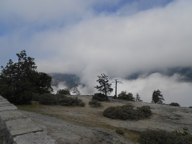
 The accompanying photos show fog in Yosemite Valley on the morning of April 22, 2012. However, it is at night when such thick fog can be crippling to motorisits.
As I was driving down at dusk from Glacier Point in Yosemite on April 24, 2012, several large and thick patches of fog drifted a long the narrow roadway.
I simply could not belive how I could only see about 5-10 feet in front of the car. Without barely being able to see the yellow line in the middle of the road and white line on roadside, I was completely blind.
When i t gets dark in mountaineous Yosemite, where there is little light poillution and when there is no moon, it is cave dartk, pitch black, and fog and compound the problem.
Luckily the 2 patches of fog only lasted about 45 seconds each and the roadway cleared, but if some areas of Yosemite are ever completely fogged in, good luck!
Snow is one thing, but fog can be worse.


Tuesday, May 1, 2012
Trapped in Yosemite National Park!

OK, Yosemite National Park in central California is a pure paradise, a Garden of Eden, a Shangri-La.
However, myself and three family members were trapped there overnight on April 22, 2012 and it was not a pleasant experience, not being prepared for an overnight stay, or having a bed or any bedding.
A huge sulphur spill just outside the south gate to Yosemite closed Highway 41 completely for some 36 hours and created a problem for hundreds of visitors.
We missed booking the last room in the historic Wawona Hotel, on south side of Yosemite, and had to crash in the lobby there overnight. (The alternative was driving some four hours on winding canyon roads in the dark -- on moonless night -- to get back to Bass Lake, where we were staying.)
Several dozen other guests were in the same boat, as the 40 vacant rooms in the Wawona had went quickly.
But a good night’s sleep you did not get and my mother with Alzheimer’s was particularly a problem. (But I guess we stayed free and saved the $165-plus hotel cost.)
Wawona is only 7 miles from the Yosemite Park gate and the spill just outside that gate at 5 p.m. on April 22 started several small fires and the cleanup kept the road closed until the morning of April 24.
No one ever explained why such hazardous materials were being transported through a national park and on such a winding, narrow road.
Also, this experience again shows that America’s National Parks are simply not prepared for any kind of disaster. All national parks appear to lack any kind of emergency communication systems.
For example, this sulphur spill happened at 5 p.m. and when I left Yosemite Valley after 8:30 p.m., there was no ranger, no system in place to tell anyone the road was closed one hour’s drive away!
Drivers had to fend for themselves and discover the road closure on their own. I guess I expect more in this high-tech world of communications.
Wawona Hotel employees said in at least a decade, even snowstorms had not closed Highway 41 before so completely and so long term.
Wawona employees did the best they could, but even this hotel appeared to have no official emergency plan in place to deal with the situation.
Couldn’t Yosemite have placed a park ranger with a flasher at the south tunnel leaving Yosemite along Highway 41 to tell motorists of what was an hour ahead? It could have, but it didn’t.
Now I could have had some emergency things along in the car, but who would expect such a closure?
I counted at least 40 cars that turned around and headed back to Yosemite and exited a different gate late that evening. They all drove some 2 hours out of their way just to exit the park. Most had to be headed for Oakhurst or beyond and so they had a longer drive ahead after leaving the park.
I felt such a drive when it was such a dark, moonless night and I was so tired was simply not a wise choice. And, the chance of animals on the road was a possibility too.
The others, like me and my group, stayed at Wawona, probably another 40-plus vehicles. And, they all had to depart Yosemite the next day a different direction, with the south entrance still closed.
Ironically this road closure happened during the annual free admission to national parks weekend.
If there was a much larger disaster in Yosemite, the park’s communications are sorely lacking.
Ideally, if Yosemite had 4 or so electronic message signs placed around the park, these could quickly alert drivers at any one of the four exits to the park of any problems ahead.
This was the SECOND time in 22 months that I’ve seen big gaps in National Park communications.
In mid-June of 2010, I entered the north gate of Yellowstone National Park one morning and headed an hour-plus drive away for Tower Junction. When I reached Tower, the road southward was blocked.
An ice storm overnight had iced the road and so it was closed until mid-afternoon, when the sun had melted the ice.
The park ranger at the north gate was not told anything about this closure and once again, visitors had to fend for themselves.


I lost hours in unnecessary travel time that day.
The director of the National Parks System needs to realize how both Yosemite and Yellowstone have no emergency communications plans in place. They are some of the most popular and largest in all the parks system and so if they are lacking, likely every other national park is too.
UPDATE: My mother came down with bacterial pneumonia a week and a half after her trapped in Yosemite experience. She'll survive and I can't be sure that one bad night weakened her, but it certainly didn't help her.
SECOND UPDATE: The park superintendent finally responded to my plight, but stressed that rangers are too busy saving lives of climbers/hikers and the like in Yosemite to worry at all about road closures.
Saturday, January 7, 2012
Why N. Utah's 'East Winds' Aren't Always From the East
Northern Utah's "canyon winds," or "east winds" are legendary.
The last such wind event struck April 30, 2016 to May 1, 2016 -- and before that, on April 9, 2013.
Residents will also not soon forget the much worse winds -- Dec. 1, 2011, when hurricane force winds hammered Davis and Weber counties in particular, causing a massive cleanup and millions of dollars in property damage.
(The damage from these winds was mostly so extreme, because it had been more than a decade since the Wasatch Front had any such wind events and so the damage came all at once, mostly from overgrown trees.)
Although the Dec. 1 winds were then the first in 12 years to hit, the winds were NOT always eastern winds and they scoured the Salt Lake Valley.
The key question is "why?"
Although I built my cedar fence strongest on the east side, that was pointless, since strong east winds have never hit my house.
In fact, the Dec. 1, 2011 winds that struck my property were straight from the north. (And they broke 4 posts along my fence's northern side.)
I asked Dan Pope, a well-known TV meteorologist, to address the question on wind direction and why "east winds" aren't always east winds.
His explanation is intriguing and worth repeating, especially since no TV weathercaster has enough air time to provide this much detail.
Dan Pope's answer:
These ... winds were "mountain wave" induced. But, the topography does force the winds to veer with distance; and due to local hills, canyons and location they can change as they move away from the mountains. They also come in rolling as they slam the ground (spinning counter clockwise).
In North Salt Lake, I have always noticed a veering to the north, because the hills by and to the north of Eaglewood Golf Course, that force the eastward track around them to flow southward. These hills are also are northeast-southeast oriented, and with City Creek Canyon on the other side, the winds likely skip over the flat area above Meridian Peak and are pushed away from the hills, protecting some of the upper Bench of North Salt Lake from the worst gusts, while Bountiful, Centerville, Farmington and areas northward are directly in line with the Wasatch Mountains, and the "wave" effect.
When we have these kinds of winds, there is usually a low pressure spinning to our south. The upper level winds come from the east or preferably the Northeast. And, at the surface, the pressure is much higher in Wyoming and lower in Utah. In a low pressure like this, sometimes a little warmer air is wrapped in above the mountain tops. This creates an inversion at 12,000 or 13,000 feet, and keeps any wind from rising--and creates a Venturi effect. Plus, the Uinta Mountains line up directly east of Bountiful and Davis County, so all wind get pushed eastward towards the Wasatch mountains from extreme Northern Salt Lake County and Davis County northward.
Rule of thumb is that winds will be 2 to 4 times higher than at mountain top as they "roller coaster" down the slopes; and they will hit beyond the base of the mountains 1/2 to 3 or 4 miles out towards the Great Salt Lake. Then they fan out, and can go in multiple directions. To the south of Davis County, they fan to the south (a north wind) and northward the can even come in from the SE if a person lives more than 3 or 4 miles from the base of the Wasatch. But, more often than not, these winds veer to the south away from the Wasatch, because the surface pressure is lower to the south.
There are certain locations near the canyons and at the base of the Wasatch in Davis, and counties northward, where these winds can be severe right at the base. Bountiful, Centerville and Farmington, as well as NE Ogden, Brigham City and even Logan fall into this category.
Subscribe to:
Posts (Atom)

